Teno Massif
Teno Massif
The Teno Massif, at the northwestern tip of Tenerife, is the island's most ancient volcanic formation. Atlantic cliffs, the village of Masca perched in its ravine and Punta de Teno compose a world apart.
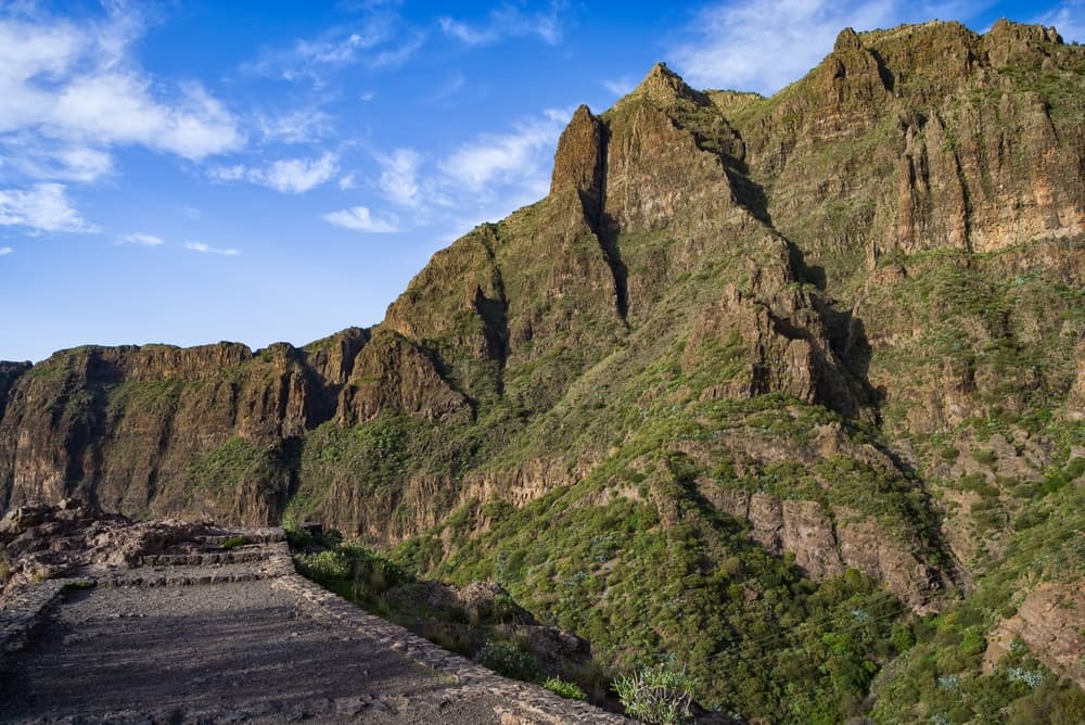
The Teno Massif occupies the northwestern corner of Tenerife. It is one of the island's three major geological units, and the oldest: its basalts date back several million years. Cliffs plunging into the Atlantic, deep ravines, white villages clinging to steep slopes — Teno offers a face of Tenerife radically different from the touristic south. The road leading there is an experience in itself.
Practical Information at a Glance
- Access: TF-445 road from Buenavista del Norte to Punta de Teno; access sometimes regulated by mandatory shuttle in high season — check before you go.
- Recommended duration: half a day minimum for Teno Point; a full day to combine hiking and villages.
- Attire: hiking boots essential on trails, hat and plenty of water.
- Accessibility: limited — trails are mostly unimproved; the road to the lighthouse is accessible by car or shuttle.
What to See
The massif divides into several distinct landscapes. Punta de Teno, the northwestern tip of Tenerife, features a lighthouse, dark lava flows and unobstructed views of La Gomera and La Palma on clear days. The Los Gigantes cliffs close off the massif to the south, toward the sea. Within, the village of Masca terraces down into a spectacular ravine, surrounded by traditional terraced agriculture.
History and Context
Teno is Tenerife's oldest volcanic shield, formed approximately eight million years ago. Intense erosion has sculpted its characteristic barrancos. Masca, long isolated by the terrain, was not connected to the rest of the island by a paved road until the twentieth century. This isolation has preserved its vernacular architecture and traditional agricultural terraces.
Highlights of the Visit
Punta de Teno
The terminal point of the massif is reached by a narrow road carved into the cliff face. The lighthouse marks the westernmost point of Tenerife. On clear days, La Gomera stands out sharply on the horizon. The black rocks and restless sea create a striking contrast with the deep blue of the Atlantic.
Village of Masca
Perched hundreds of metres above sea level within its namesake barranco, Masca is one of Tenerife's best-preserved villages. Its dry-stone houses, narrow alleyways and terraced gardens merit a stop. The trail descending to Masca beach is a demanding but reputable hike.
Northern Coastal Road
The TF-445 winds along dizzying cliffs between Buenavista del Norte and the point. Driving demands care, but natural viewpoints over the ocean justify every turn. Several informal stops allow for photographing the precipices.
Photography Tips
Morning light is ideal at Punta de Teno: the sun illuminates the cliffs head-on and the sea is often calmer. For Masca, late afternoon golden light warms the ravine walls. Avoid midday in summer: heat haze and backlighting are common. A wide-angle lens better conveys the scale of the cliffs.
Location and Access
The Teno Massif lies at the northwestern tip of Tenerife, roughly an hour's drive from Puerto de la Cruz and more than two hours from the island's south. The natural departure point is Buenavista del Norte, reachable from Los Gigantes or Garachico. In high season, access to Punta de Teno may be limited to official shuttles from Buenavista — check with your local operator. No regular public transport serves the point.
Nearby Attractions
- Los Gigantes — Tenerife's highest marine cliffs close off the massif to the south; departure point for boat excursions.
- Garachico — former trading port on the northern coast, with its natural lava pools and preserved historic centre.
- Icod de los Vinos — town known for its thousand-year-old dragon tree, a few kilometres east on the TF-42.
- Buenavista del Norte — quiet town at the foot of the massif, the logical starting point for exploring Teno.
Frequently asked questions
In high season, access by private vehicle may be restricted and replaced by shuttle from Buenavista del Norte. Check current regulations with the Cabildo de Tenerife or your operator before your visit.
The trail descends approximately 500 metres over rocky and sometimes slippery terrain. It is classified as moderate to difficult. Hiking boots, water and good fitness are essential. The return climb is challenging in intense heat.
Spring (March–May) and autumn (September–November) offer pleasant temperatures for hiking and lush vegetation. Summer is hot and busy; winter remains mild but can be windy on the point.
Yes, the two sites are linked by the coastal road. One day suffices to visit Punta de Teno in the morning and reach Los Gigantes in the afternoon, with a stop at Masca if you skip the full hike.
Masca has a few small restaurants and bars. At Punta de Teno, there are no services. Bring adequate water and food before leaving Buenavista del Norte.
Interested in this visit?
We can include it in your personalised itinerary.